Since I have been recently taking up an interest in mountain biking, I wanted to find a challenge that would test the skills I had been practicing. Being so close to Oregon, I began my search for a difficult mountain biking trail and ended up finding a wide variety of options. So, I put together a list of the 15 toughest mountain bike trails in Oregon.
So here is the list of the 15 toughest mountain bike trails in Oregon:
- Funner Trail – Bend, Oregon
- Surveyor’s Ridge – Mount Hood, Oregon
- Castle Rock – Rainbow, Oregon
- Whoops Trail – Bend, Oregon
- Shelburg Falls – Mehama, Oregon
- The Lair – Bend, Oregon
- Grand Slam – Bend, Oregon
- Eagle’s Rest – Oakridge, Oregon
- Eula Ridge – Oakridge, Oregon
- Elkhorn Crest National Recreation Trail #161 – Baker City, Oregon
- Shoot Dang! – Seaside, Oregon
- Lookout Mountain – Prineville, Oregon
- Lower Whoops – Bend, Oregon
- Ben’s Upper – Bend, Oregon
- Larison Rock – Oakridge, Oregon
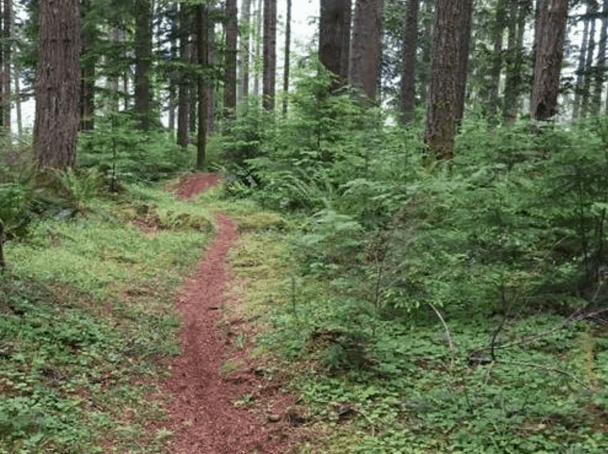
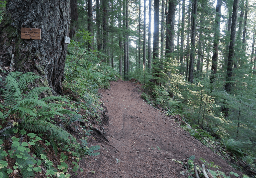
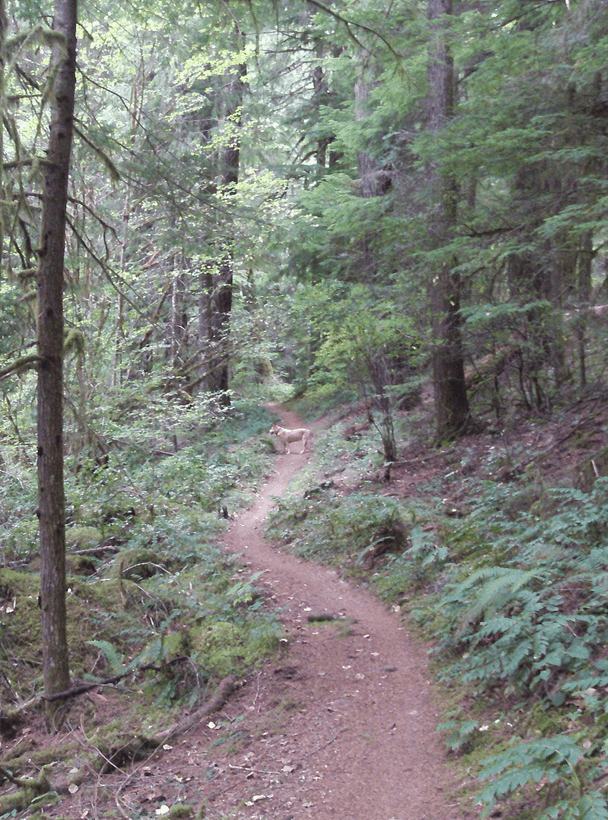
Some of the toughest mountain bike trails in Oregon are located in the cities of Bend, Oakridge, and more. These mountain biking trails are nestled in the lush green forests of the Oregon mountains, and consist of several technical challenges for the experts.
When it comes to learning the skill of mountain biking, there will always come a time where the enthusiastic bikers will seek out a challenge to conquer, and there is no better place to do this than Oregon.
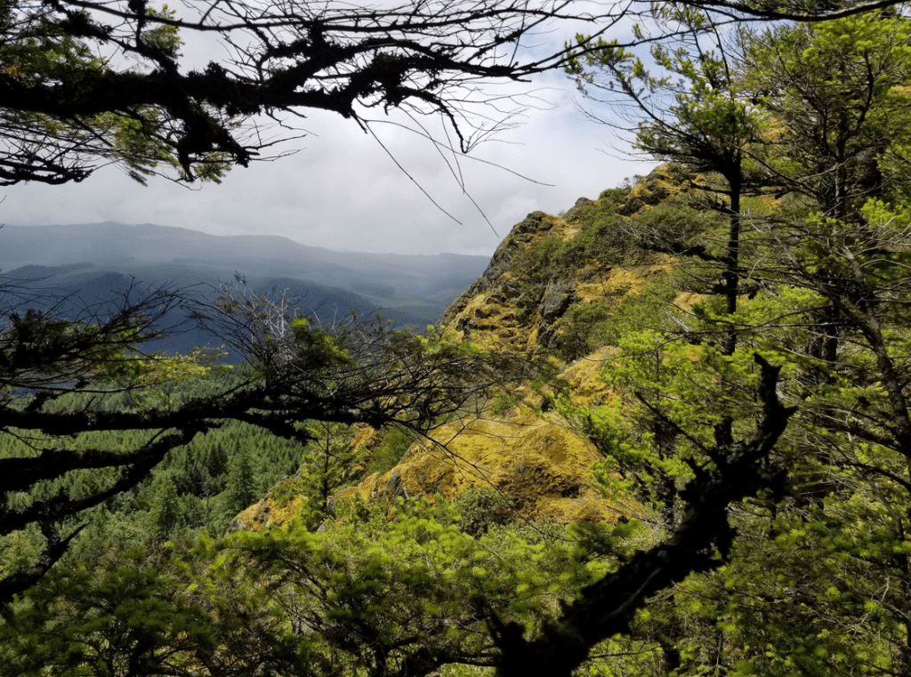
With beautiful weather and lush greenery all around, the state of Oregon is the perfect location to push yourself to the limit behind the handlebars of a mountain bike. If you are an Oregon local or you are planning to visit, this comprehensive list will tell you everything you need to know about the most advanced mountain biking trails around.
Funner Trail – Bend, Oregon
Trail Length: 7 miles
Difficulty Level: Advanced
Elevation: 5,395 feet
Funner is an advanced single track mountain biking trail located in the city of Bend, Oregon. The total length of the trail is 7 miles both ways, with over five thousand feet of elevation throughout the climb.
The first mile of this trail is very windy, with a lot of sharp twists and turns. However, this will only be the beginning of a challenging trail through the man made features on this trail that were implemented for a thrilling mountain biking ride.
Somewhere along this trail, you will notice a lava rock garden that you didn’t expect. Enter if you dare, and head down the hill afterward if you are able to navigate switches and drops everywhere you turn.
The Funner trail comes to an end right in the middle of the Tiddlywinks and Storm King Trails. If the 7 mile journey is not long enough and you are up for an extra challenge, you can ride up the mountain on the Tiddlywinks trail and exit the mountain on the Funner tail from the Wanoga snow-park.
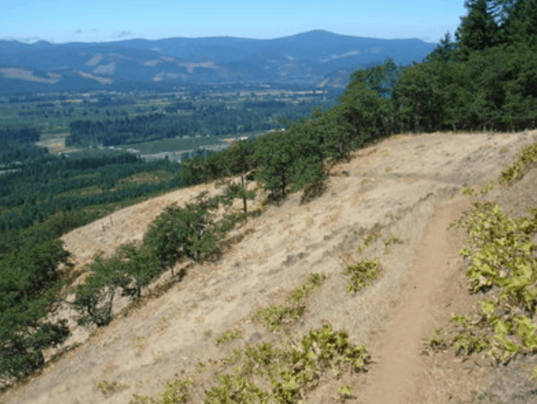
Surveyors Ridge – Mount Hood, Oregon
Trail Length: 20 miles
Difficulty Level: Advanced
Elevation: 4,261 feet
Surveyor’s Ridge is an advanced difficulty level mountain biking trail that is located in Mount Hood, Oregon. The trail is single track, but that does not make it any less challenging for the eager mountain biker.
Due to its central location, this particular trail offers striking views of Mt. Hood from all around. In fact, it might be hard to continue on the trail at such a fast speed without wanting to look at the picturesque scenery.
If you can get over how beautiful your surroundings are, you will certainly be in for a treat on this mountain biking trail.
A helpful tip for Surveyor’s Ridge is to ride back down the mountain on the trail, instead of moving to the road. This will give you the ultimate mountain biking experience from start to finish.
While you are riding through this trail, be aware of wildlife that you might come in contact with. After all, you will be riding through a mountain habitat where several species reside, so don’t be surprised if you pass by a deer or a bear.
To access the trail, you can ride up the Dog River Trail, and use Surveyor’s Ridge to get to Oak Ridge at the end. However, if you’re not up for the long ride there is always the option to take the shuttle with your bike.
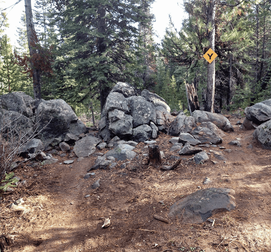
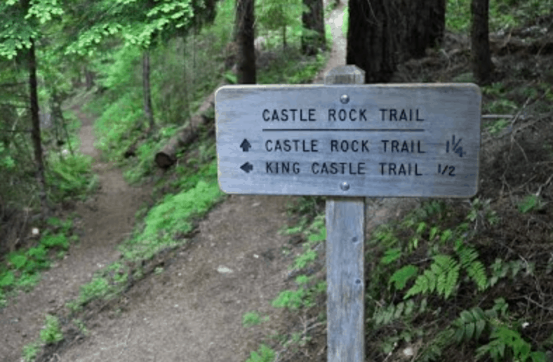
Castle Rock – Rainbow, Oregon
Trail Length: 27 miles
Difficulty Level: Expert
Elevation: 1,239 feet
The Castle Rock Trail in Rainbow, Oregon is a single track mountain biking trail that is fashioned in the form of a loop. This is one of the most scenic mountain biking trails in Oregon, with a variety of different terrains all throughout the path.
Within the trial, you will come across one particular area that is full of rocks that also contains a pretty significant drop. This is one of the less crowded trails, so you will be in luck if you want to have the trail mostly to yourself. As an added bonus, the pathway does not get slippery when it is wet, so you can ride along this trail in rain or shine.
There are also plenty of nearby activities and resources to the Castle Rock trail. You can find bike races and local bike shops near the ends of the pathways for your entertainment and convenience. You can even turn your mountain biking trip into an overnight stay with all of the centrally located camp sites.
The Castle Rock mountain biking trail is a total of 27 miles long in full, but there is the option to take a shortcut that is only 26 miles long. While it is not much of a difference as far as distance goes, the most advanced mountain bikers who are looking for a real challenge should complete the full 27 mile count.
Whoops Trail – Bend, Oregon
Trail Length: 2 miles
Difficulty Level: Advanced
Contrary to most of the other mountain biking trails that have been previously mentioned in this article, the Whoops trail might not be exactly what you would expect to find on this list. Located in Bend, Oregon, this is an advanced trail with a short length of only 2 miles in total.
While it is true that this particular mountain biking trail is considered advanced, it does not have much in common with the steep climbs that come with the other nearby trails. Instead, this trail is more ideal for experienced mountain bikers who would like to test their riding skills when it comes to making quick turns at fast speeds.
However, the Whoops Trail is not to be confused with an easy or beginner level trail. In fact, it will require a lot of practice and skill to be able to navigate the winding pathway, and should only be attempted by seasoned mountain bikers.
The terrain throughout this trail is generally rocky, with sand on the surface of the ground. Many mountain bikers near and far have reported Whoops to be very flowy and exhilarating to ride, and have repeated the route multiple times in the same day.
Shelburg Falls – Mehama, Oregon
Trail Length: 12 miles
Difficulty Level: Advanced
Elevation: 916 feet
The Shelburg Falls mountain biking trail is nestled in the mountains of Mehama, Oregon. It is a single track pathway that is geared for the most advanced mountain bikers.
With a total trail length of 12 miles, you will begin your journey on a road that is covered in gravel for several miles before you reach the parking area past the waterfalls.
The entire trail itself is a network loop that can be traveled in more ways than one. If you are looking to cover the most distance on your mountain biking journey, you should continue your initial climb toward the top of Lookout Mountain road at the intersection throughout your journey.
Shelburg Falls is ideal for any type of advanced mountain biker who is looking for a challenging trail, at any time of the day. This is one of the bike trails in Oregon that support night riding, meaning that you can travel through this pathway even when the sun is down.
Throughout your journey through this trail, you can find local bike shops, races, hiking, and even camping. The scenery that you will discover throughout your trip will be beautiful and green, with almost two miles of private property at the beginning of the trail.
You can loop through the Vine Maple Trail once you reach it, or continue past the end of this trail and continue onto Lost Creek for an extended ride. Regardless of how you choose to conclude your ride, the Shelburg Falls trail will definitely have you catching your breath due to the bumpy terrain and steep uphill climbs.
The Lair – Bend, Oregon
Trail Length: 3 miles
Difficulty Level: Expert
Elevation: 3,923 feet
The Lair is a mountain bike park that is located in the city of Bend, Oregon. With a total of 3 miles on the entire trail, this mountain bike pathway is a network that is organized in a progression.
When you enter this trail, you will be warmed up with beginner level jumps that are only a few feet tall, all the way up to the most expert level drops totaling about 20 feet total. The entire trail is considered to be of maximum difficulty, however, and goes up to an elevation of almost four thousand feet.
The special thing about this particular trail is that it was built by local volunteers from the Oregon Trail Alliance, most commonly known as COTA. This man-made trail was made possible by a partnership with the Forest Service in the area, with the allowance to construct the pathway on Forest Service land.
Even still to this day, The Lair is maintained by the same organization of enthusiastic volunteers that built it in the first place. In fact, you might still come across a few people with tools making improvements to the trail.
However, this work is not limited to only the members of the COTA. If you ever have some extra time on your hands when you are riding through The Lair, you can stop to ask them if they need any assistance making adjustments to make this 3 mile trail even more enjoyable.
Grand Slam – Bend, Oregon
Trail Length: 6 miles
Difficulty Level: Advanced
Grand Slam is another challenging mountain biking trail located in Bend, Oregon, similar to many of the others on this list. In order to access this trail, you will need to both enter and exit through the Phil’s Trail network.
The trail itself is a single track road, and follows a pretty consistent downhill slope throughout the majority of the ride. While Grand Slam is surrounded by some of the more well known mountain biking routes such as Whoops, the difficulty of this trail should not be underestimated.
While navigating through Grand Slam, you can expect to see thick green forests toward the higher end of the trail, with plenty of trees and even a canyon during the first several miles of the journey.
Soon after, you will be able to coast through the trail on more flat ground, with a listle over 2 miles that do not contain any major twists and turns or jumps. However, you should not underestimate the trail at this point, due to the relatively calm terrain that you have experienced for the initial portion of the ride.
If you were under the impression that you would be able to easily glide through the remainder of the Grand Slam trail, you will quickly find out that you were mistaken once you reach the more technical areas immediately after you cruise through the smoothest part of the ride.
This section of the trail will include large collections of rocks, downhill slopes, quick turns, and really tight switchbacks. You will be able to choose from continuing through the rest of the Grand Slam trail or turning the opposite way to climb upward through VooDoo instead.
When your entire 6 mile journey on the Grand Slam trail has finally concluded, you will end up right back at Phil’s Trail, so long as you stuck the whole thing out as planned.
Eagle’s Rest – Oakridge, Oregon
Trail Length: 3 miles
Difficulty Level: Advanced
Elevation: 1,672 feet
The Eagle’s Rest mountain biking trail in Oakridge, Oregon is considered to be of advanced level for experienced mountain bikers. The trail is formulated in an “out and back” fashion, almost creating a loop throughout the entire pathway.
When you finish the entire Eagle’s Rest trail, you will have traveled a total of 3 miles. Even though the distance is somewhat shorter than what you might have been expecting for an advanced mountain biking trail, there is no shortage of elevation on this journey.
For those who are looking for more of a challenge or just a longer mountain biking ride in general, this trail can be entered from Goodman’s Creek, when previously traveled.
When you are in search of an even more tricky task, you can follow this trail right up to the Eagle’s Rest knob, where you can scale the mountain behind the handlebars of your bike to a total elevation of over three thousand feet.
Even if you decide to to take the 3 mile trip through just Eagle’s Rest alone, you will not have it any easier than those who choose the latter. The terrain of the trail itself is rocky and grassy, with plenty of obstacles to be thrown in the path of your tires to throw you off a little bit.
This trail is ideal for mountain bikers who are experienced with the sport and well trained to be able to handle intense climbing and cardio while trying to cut through the thick vegetation and obstructions that govern the pathway.
Eula Ridge – Oakridge, Oregon
Trail Length: 6 miles
Difficulty Level: Advanced
Elevation: 975 feet
When it comes to seeking out the most advanced and expert-level mountain biking trails throughout the entire state of Oregon, the Eula Ridge trail goes head up with all of the other contenders.
With a total trail length of 6 miles from beginning to end, you will certainly be in for the challenge that you seek when you enter the head of this trail on your mountain bike. The first several miles will be very technically challenging.
You can expect to ride through a very narrow trail that is highly elevated, with tight switches and frequent turns. Just in case that part wasn’t enough, the trails are also very rocky, with stray objects and plants in your path to keep the challenge in place.
Although it is true that several miles of this trail are rather difficult to navigate and will require a lot of technical skill and practice as well as training, you will have a few breaks in between these areas.
Mountain bikers who dare to ride through Eula Ridge will be able to enjoy faster and easier sections downhill toward the end of the trail. Right before you reach the very end of your journey, you will experience a few thrilling switchbacks until you successfully make it back to the ground level.
While it is true that the brave mountain bikers get a little bit of a break when the trail has come to an ending, the first few miles is near-expert level. Even some of the most experience riders have complained about having to get off their bikes during travel at the beginning of this trail. So, the only question is, will you make it to the top?
Elkhorn Crest National Recreation Trail #1611 – Baker City, Oregon

Trail Length: 2 miles
Difficulty Level: Expert
Elevation: 4,462 feet
Elkhorn Crest #1611 is a popular National Recreation Trail in Baker City, Oregon. Located within the Blue Mountains region, it is considered to be the highest elevated mountain biking trail.
Throughout the duration of this trail, you will notice expansive views of the Baker Valley, along with the Wallowa and Blue Mountains that are located even further into the distance.
In order to access this particular trail, there are several options for how you can enter and get started on your journey. Some of the most common choices for trail entry include the openings from the area closest to the Marble Pass Trailhead and Anthony Lakes.
While the scenery that you will notice on this trail is very beautiful, you most likely will not have much time to stop and take a look. This is due to the expert difficulty level of this trail specifically.
Upon getting started on this trail, you can expect to experience over one thousand feet of elevation throughout just the first two miles of the path. If you are able to get past this point, you will be rewarded with an easier trek toward the Marble Creek Pass.
The total elevation of this entire network trail amounts to 4,462 feet high. While this trail is among the much shorter options on this list when it comes to the duration, many bikers will choose to ride through it in connection with another nearby trail that opens into it.
Shoot Dang! – Seaside, Oregon
Trail Length: 2 miles
Difficulty Level: Advanced
Elevation: 77 feet
The Shoot Dang! Trail in Seaside, Oregon is one of the newest mountain biking trails that is outlined within this list. With the pathway itself being newly built, it might seem like there is not much to it as of yet.
However, this could not be further from the truth. The total elevation of this entire trail is 77 feet across its entire two mile length. This single track trail is considered to fall under the advanced category of mountain biking difficulty levels.
The entire trail can be completed in just under two minutes, with the average time being exactly one minute and thirty-seven seconds. It is intended to serve as a connection between other trails, which have not yet been built in the area.
If you have some extra time, you will be able to find a plethora of local bike shops and mountain biking races, along with other activities from hiking to camping within the same mountain region.
It never hurts to visit the Shoot Dang! Trail and try it for yourself as a quick challenge of your mountain biking skills, or you can stay posted to find out when all of the connections are complete for a much longer ride in the future.
Lookout Mountain – Prineville, Oregon
Trail Length: 20 miles
Difficulty Level: Advanced
Elevation: 3,989 feet
The Lookout Mountain biking trail is one of the most scenic and beautiful locations that have been mentioned throughout this article. Located in Prineville, Oregon, this pathway is almost as serene as they come.
You will be able to enjoy strikingly gorgeous views of mountain tops that look like they are close enough to touch, with no shortage of steep climbs throughout your journey. There are also plenty of downhill sections to accompany the more difficult climbs.
The beginning of the pathway will include the majority of the climbing part of the trail, which will amount to somewhere around two thousand feet.
The trail is fashioned in the form of a loop that is a total of 20 miles long from start to finish. The total elevation of the climb behind the handles of your mountain bike will be very close to four thousand feet.
Lower Whoops – Bend, Oregon
Trail Length: 2 miles
Difficulty Level: Advanced
The Lower Whoops Trail is another one of the shorter mountain biking trails in the state of Oregon, but this is not to say that its difficulty level does not match the others on this list.
With a total length of just two miles throughout the entire journey, this advanced trail is free-flowing with some occasional jumps here and there. However, it is nothing that the seasoned mountain biker cannot handle.
The entire trail will take you out and back form start to finish, on top of a dirt road surface instead of a single track like most others. After you have navigated through the dips and jumps successfully, you will enjoy a smooth downhill transition back to where you started.
Ben’s Upper – Bend, Oregon
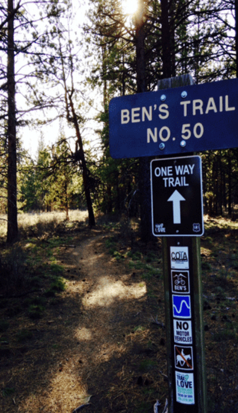
Trail Length: 2 miles
Difficulty Level: Advanced
Ben’s Upper is a mountain biking trail that is, once again, located in the city of Bend, Oregon. This is another one of the shorter pathways that are ideal for expert riders.
With a total length of 2 miles, this trail can be connected with other nearby pathways, or travelled all by itself. Ben’s Upper can be navigated within a time period of approximately 3 minutes.
While it is true that this single track network trail will not be the longest journey out of the items on this list, you will definitely be in for a challenge when you reach the tricky technical sections with jumps and gravel covering the trail.
Larison Rock – Oakridge, Oregon
Trail Length: 5 miles
Difficulty Level: Advanced
Elevation: 1,168 feet
Last but not least, the Larison Rock trail is located in the city of Oakridge, Oregon. The initial two miles on this 5 mile biking trail consist of a very steep climb uphill, with not much of a relief after it has been surpassed.
Throughout the rest of this trail, you can expect to come across fast switchbacks and some more intense pedaling, in addition to what you had done in order to scale the mountain in the first place.
It is not until the end of the trail when you will be able to relax your pedals on a smooth downhill ride, proving all of your hard work to be worth it once you complete your journey successfully.